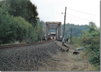
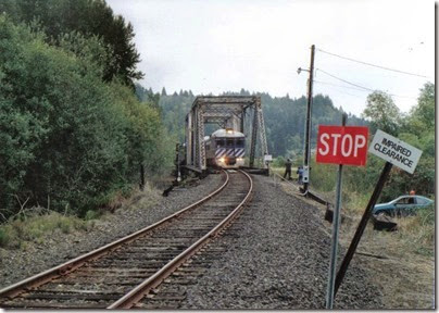
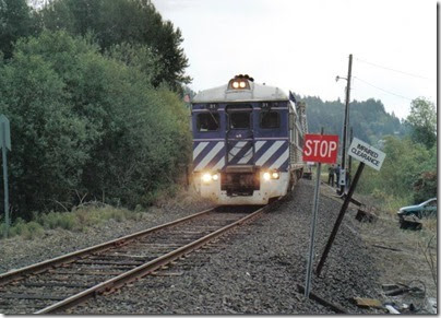
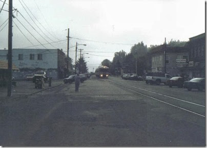
Wednesday, March 26, 2014

Lewis & Clark Explorer: Conclusion

…Continued from Astoria.

This concludes my coverage of the Lewis & Clark Explorer.

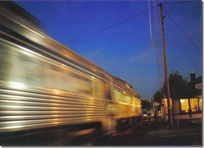
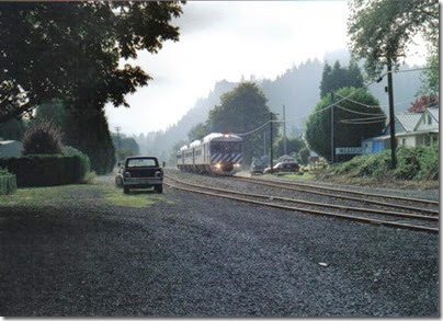
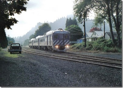
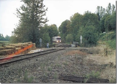
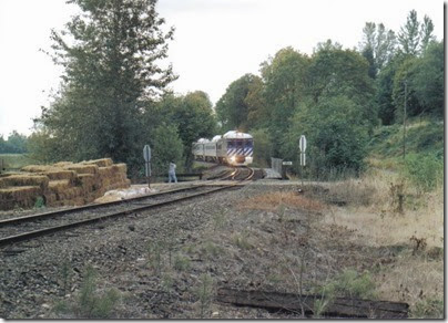
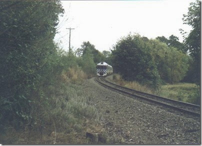
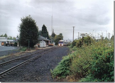
For a parting shot, here is a night picture of the Lewis & Clark Explorer passing the St. Helens depot on the return trip to Linnton.

Lewis & Clark Explorer passing the depot in St. Helens, Oregon on September 24, 2005
Lewis & Clark Explorer passing the St. Helens depot on September 24, 2005.

After the end of the Lewis & Clark Explorer's final season in 2005, the Budd RDCs were stored for a time and were eventually sold to the Wallowa Union Railroad in eastern Oregon for use on the Eagle Cap Excursion Train beginning in 2007.

Lewis & Clark Explorer Links:
Lewis & Clark Explorer Train
Lewis & Clark Bicentennial in Oregon: Main Page
Brian McCamish's Lewis & Clark Explorer Page
Return of the Budd at The Northwest's Own Railfan

Lewis & Clark Explorer: Astoria

…Continued from Knappa.

astoriasign

Astoria is the oldest settlement west of the Rocky Mountains. Fur traders sent by John Jacob Astor built Fort Astoria in 1811. Astoria is the county seat of Clatsop County. According to the 2000 census, Astoria has a population of 9,813 people.

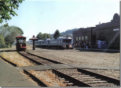
Lewis & Clark Explorer at the depot in Astoria, Oregon on September 24, 2005
The Lewis & Clark Explorer at the Astoria depot on September 24, 2005.

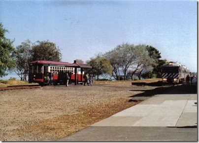
Lewis & Clark Explorer & Astoria Riverfront Trolley at the depot in Astoria, Oregon on September 24, 2005
The Lewis & Clark Explorer at the Astoria depot on September 24, 2005. The Astoria Riverfront Trolley is on the left.

The Lewis & Clark Explorer's journey ends, appropriately enough, in front of the old Astoria railroad depot. The depot was built in 1924, the peak year for rail travel in Astoria. The railroad continued to use the building for decades after passenger service ended, but today the building is owned by the Columbia River Maritime Museum. It is closed to the public as it is in need of serious repair and is only used for storage.

Astoria Riverfront Trolley and the Lewis & Clark Explorer in Astoria, Oregon on September 24, 2005
The Astoria Riverfront Trolley and the Lewis & Clark Explorer on September 24, 2005.

The tracks along the waterfront through Astoria are used by the Astoria Riverfront Trolley.

Lewis & Clark Explorer leaving Astoria, Oregon on September 24, 2005
The Lewis & Clark Explorer leaving Astoria on September 24, 2005.

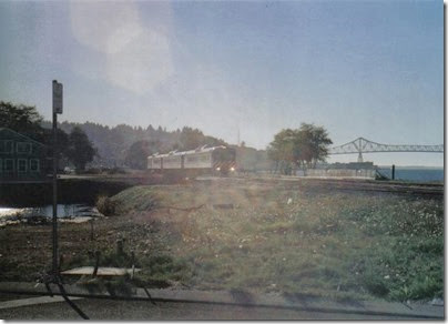
These pictures show the Lewis & Clark Explorer passing by the site of the old engine terminal while leaving Astoria for the return trip to Linnton.

Lewis & Clark Explorer leaving Astoria, Oregon on September 24, 2005
The Lewis & Clark Explorer leaving Astoria on September 24, 2005.

Lewis & Clark Explorer leaving Astoria, Oregon on September 24, 2005
The Lewis & Clark Explorer leaving Astoria on September 24, 2005.

Lewis & Clark Explorer leaving Astoria, Oregon on September 24, 2005
The Lewis & Clark Explorer leaving Astoria on September 24, 2005.

Continue to Conclusion

Lewis & Clark Explorer: Knappa

…Continued from Westport.

knappasign

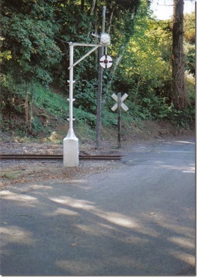
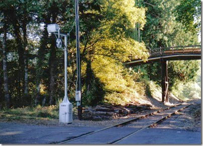
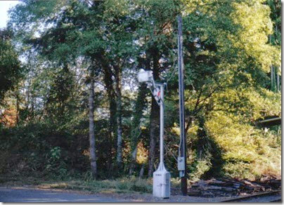
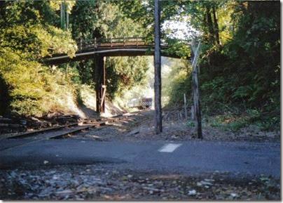
The town of Knappa was named after Aaron Knapp, Jr., an early settler of the area. The Knappa post office operated from 1873 to 1943. The actual town of Knappa is actually a little inland from the river, and the railroad stays close to the river here and doesn't actually go through Knappa. Two roads cross the railroad at Knappa. Knappa Road crosses above the tracks on an old wooden overpass. Waterhouse Road crosses the tracks at a traditional grade crossing. But this grade crossing is unique; it is still protected by an antique railroad crossing signal known as a Magnetic Flagman or wigwag.

Wigwag at Knappa, Oregon on September 24, 2005
Wigwag at Knappa on September 24, 2005.

This type of signal was manufactured by the Magnetic Signal Company of Los Angeles, California from 1910 to 1949. It takes its name from the movement it makes; the black and white banner with the red light in the middle swings, "wigwags" back and forth. The movement is similar to that made by a human flagman while swinging a flag or lantern to stop traffic. The signal also features a bell.

 Wigwag at Knappa, Oregon on September 24, 2005
Wigwag at Knappa on September 24, 2005.

Just north of the tracks, Waterhouse Road turns to intersect with Knappa Road, which is just to the east. The Knappa Road overpass is adjacent to the Waterhouse Road crossing, making this a very photogenic spot for train photographs. Unfortunately, the Portland & Western has no freight business this far down the line, so without the Lewis & Clark Explorer train, this area sees almost no rail traffic.

Wigwag at Knappa, Oregon on September 24, 2005
Wigwag at Knappa, swinging, on September 24, 2005.

Wigwag at Knappa, Oregon on September 24, 2005
Wigwag at Knappa, swinging, on September 24, 2005.

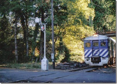
Lewis & Clark Explorer passing through Knappa, Oregon on September 24, 2005
The Lewis & Clark Explorer passing through Knappa on September 24, 2005.

Lewis & Clark Explorer passing through Knappa, Oregon on September 24, 2005
The Lewis & Clark Explorer passing through Knappa on September 24, 2005.

Wigwag at Knappa, Oregon on September 24, 2005
Wigwag at Knappa, swinging after the train, on September 24, 2005.

The wigwag was removed in March of 2007.

For more information on wigwags, visit Dan's Wigwag Site.

Continue to Astoria

Lewis & Clark Explorer: Westport

…Continued from Clatskanie.

westportsign

Lewis & Clark Explorer passing through Westport, Oregon on September 24, 2005
The Lewis & Clark Explorer passing through Westport on September 24, 2005.

John West settled in Westport in 1850. The post office opened in 1863. Westport is located on Westport Slough, a side channel of the Columbia River. This location shelters the shore at Westport from the current in the river's main channel, making the slough a relatively good place for boaters and fishermen. Since 1925, a car ferry has connected Westport with Puget Island. Originally a second ferry connected the town of Cathlamet, Washington with Puget Island, however in 1938 a bridge between Puget Island and Cathlamet was completed, leaving only the Westport ferry. Wahkiakum County, Washington has operated the Westport ferry since 1960. The current ferry, named the Wahkiakum, has been in service here since 1961. This small ferry operation proves itself essential when construction or another emergency temporarily closes one of the bridges at Rainier or Astoria. The pictures show the Lewis & Clark Explorer as it moves through Westport at a surprisingly fast pace.

Lewis & Clark Explorer passing through Westport, Oregon on September 24, 2005
The Lewis & Clark Explorer passing through Westport on September 24, 2005.

Continue to Knappa

Lewis & Clark Explorer: Clatskanie

…Continued from Rainier.

clatskaniesign

Clatskanie takes its name from the Tlatskanai Indians, a very warlike tribe that inhabited this area. The Tlatskanai were wiped out by a smallpox epidemic in the 1850s. Clatskanie was first settled in 1852. It was originally called Bryantville. Clatskanie was incorporated in 1891. According to the 2000 census, Clatskanie has a population of 1,528 people.

Hand-cranked swing bridge at Clatskanie, Oregon, on September 24, 2005
Hand-cranked swing bridge at Clatskanie, Oregon, on September 24, 2005.

Hand-cranked swing bridge at Clatskanie, Oregon, on September 24, 2005
Hand-cranked swing bridge at Clatskanie, Oregon, on September 24, 2005.

Unlike the other towns, which the railroad runs right through the middle of, the railroad only skirts along the edge of Clatskanie. At the west end of town, the railroad crosses the Clatskanie River on a swing-type drawbridge built in 1897. This bridge must be manually swung by a handcrank in the center of the span. This is the first of three manual drawbridges the train crosses. The bridge is normally kept open for river traffic, and is only swung closed when a train is waiting. For freight trains, a railroad employee swings the bridge. For the Lewis & Clark Explorer, the bridge was swung by specially trained volunteers. In these pictures, taken from the west side of the bridge, you can see the walkway to get to the span when the bridge is open, and the volunteer walking around the circular walkway in the middle, using the removable pole to turn the handcrank.

Lewis & Clark Explorer crossing the Clatskanie River drawbridge at Clatskanie, Oregon on September 24, 2005
The Lewis & Clark Explorer crossing the Clatskanie River drawbridge on September 24, 2005.

Lewis & Clark Explorer crossing the Clatskanie River drawbridge at Clatskanie, Oregon on September 24, 2005
The Lewis & Clark Explorer crossing the Clatskanie River drawbridge on September 24, 2005.

Lewis & Clark Explorer crossing the Clatskanie River drawbridge at Clatskanie, Oregon on September 24, 2005
The Lewis & Clark Explorer crossing the Clatskanie River drawbridge on September 24, 2005.

This is the bridge at which the Portland & Western freight train crew pushed a carload of lumber into the river on September 2, 2004. The train was operating on the east side of the bridge, so in the pictures it is the far approach that was damaged. Since the bridge was completely open at the time, the main span was not damaged.

Lewis & Clark Explorer leaving Clatskanie, Oregon on September 24, 2005
The Lewis & Clark Explorer leaving Clatskanie on September 24, 2005.

Continue to Westport

Lewis & Clark Explorer: Rainier

…Continued from Goble.

rainiersign

Charles Fox founded Rainier in 1851. The town was originally called Eminence, but the name was changed to Rainier in 1852. The town is named after Rear Admiral Peter Rainier of the Royal Navy, for whom Mt. Rainier in Washington is also named. The town of Rainier was incorporated in 1885. According to the 2000 census, Rainier has a population of 1,687 people.

Lewis & Clark Explorer in Rainier, Oregon on September 24, 2005
The Lewis & Clark Explorer in Rainier, Oregon on September 24, 2005.

Lewis & Clark Explorer in Rainier, Oregon on September 24, 2005
The Lewis & Clark Explorer in Rainier, Oregon on September 24, 2005.

Lewis & Clark Explorer in Rainier, Oregon on September 24, 2005
The Lewis & Clark Explorer in Rainier, Oregon on September 24, 2005.

Lewis & Clark Explorer in Rainier, Oregon on September 24, 2005
The Lewis & Clark Explorer in Rainier, Oregon on September 24, 2005.

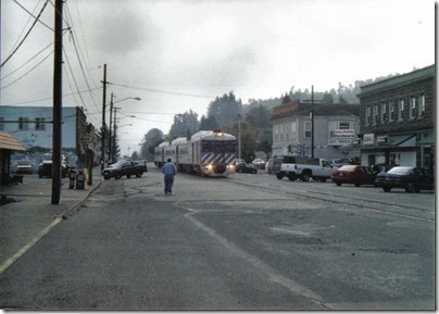
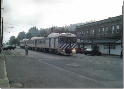
Rainier is my hometown, so it is covered more extensively than the other towns on this page. The railroad runs down the middle of A Street in downtown Rainier. Street-running used to be common for railroads in the United States, but today it is becoming rare.

Lewis & Clark Explorer crossing Fox Creek in Rainier, Oregon on October 1, 2005
The Lewis & Clark Explorer crossing Fox Creek on October 1, 2005.

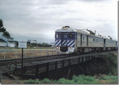
After leaving the street-running behind, the railroad crosses over Fox Creek on an old wooden trestle that probably dates from the railroad's original construction in the 1890s.

Lewis & Clark Explorer west of Rainier, Oregon on September 24, 2005
The Lewis & Clark Explorer west of Rainier, Oregon on September 24, 2005.

Lewis & Clark Explorer west of Rainier, Oregon on September 24, 2005
The Lewis & Clark Explorer west of Rainier, Oregon on September 24, 2005.

Lewis & Clark Explorer west of Rainier, Oregon on September 24, 2005
The Lewis & Clark Explorer west of Rainier, Oregon on September 24, 2005.

Lewis & Clark Explorer west of Rainier, Oregon on September 24, 2005
The Lewis & Clark Explorer west of Rainier, Oregon on September 24, 2005.

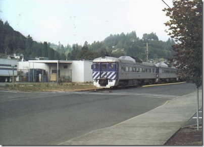
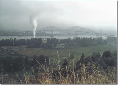
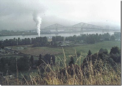
West of Rainier, Highway 30 climbs in elevation. Viewpoints along the highway offer westbound travelers the opportunity to stop and enjoy the views of the Columbia River, the mills of Longview, Washington and the Lewis & Clark Bridge, designed by Joseph Strauss of Golden Gate Bridge fame and completed in 1930. These viewpoints also offer an excellent view of the Lewis & Clark Explorer as it passes under the bridge and along Dike Road between farmland and USG's wallboard plant.

Continue to Clatskanie

Lewis & Clark Explorer: Goble

…Continued from Tide Creek.

goblesign

In August 1852, a trapper from Ohio named Daniel Blue Goble took a donation land claim along the Oregon side of the Columbia River. He later sold the land to George Foster, who laid out a town on the site which he called Goble after the original owner. Today, despite its location on Highway 30 and the Columbia River, Goble is an unincorporated, unremarkable locale consisting almost entirely of a small marina and the Goble Tavern. There hasn't even been a Goble post office since 1923. But over a century ago, Goble was not only an important railroad junction, it was the reason the railroad was there at all.

The Northern Pacific Railway had built a transcontinental railroad across the northern United States, with its western terminus in Seattle. Wanting to build a connection to Portland, the Northern Pacific had built south from Seattle, reaching Kalama, Washington by 1874. Passengers then had to be transferred to steamboat to reach Portland. In order to try to close the gap, Northern Pacific built north from Portland along the Columbia River to Goble, directly across from Kalama, arriving in 1883. This allowed trains to cross the river, initially aboard a barge and beginning in 1884 aboard the steam ferry Tacoma, and continue on their way. The Tacoma, initially called the Kalama, was the world's second-largest ferry at the time at 338 feet in length. It was built in Delaware, disassembled and shipped in 57,159 pieces from New York around Cape Horn to Portland aboard the Tillie E. Starbuck, reassembled in Portland and launched by Smith Brothers & Watson on May 17, 1883. The ferry entered service on October 9, 1884 under the command of Captain George Gore, carrying entire trains, including locomotives, across the Columbia River between Kalama and Goble. This arrangement continued until 1908, when the Northern Pacific completed a route on the Washington side of the river, including a drawbridge between Vancouver, Washington and Portland, Oregon, where the river was narrower. That drawbridge is still in use today.

Historical Information & Photos

Steam Ferry Tacoma at Kalama in 1885 from the Washington State Historical Society

Kalama waterfront & ferry landing, circa 1890, from the Washington State Historical Society

Steam Ferry Tacoma, from Washington's Secretary of State's Cowlitz County History Page

Meanwhile, the people of Astoria wanted a rail connection to the rest of the country. In 1895, the Astoria & Columbia River Railroad was incorporated to build a railroad connecting Astoria to the Northern Pacific at Goble. This new railroad was completed on April 4, 1898, and the first train from Portland to Astoria ran on May 16. James J. Hill, founder of the Great Northern Railway, and also part owner of the Northern Pacific and Spokane, Portland & Seattle Railways, purchased the Astoria & Columbia River Railroad in 1907. In 1911, the entire line from Portland to Astoria was transferred to the Spokane, Portland & Seattle Railway. By that time, the new Northern Pacific line on the Washington side of the river was the main mine, and the original line to Goble was regulated to local trains.
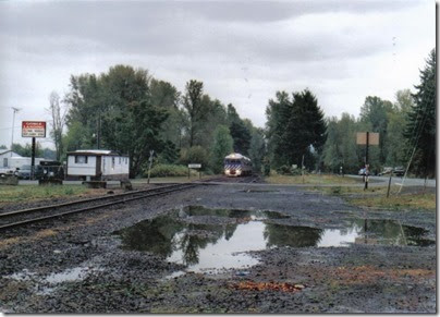
Lewis & Clark Explorer at Goble, Oregon on October 1, 2005
The Lewis & Clark Explorer at Goble, Oregon on October 1, 2005.

Today, there is almost no indication of Goble's importance to the railroad, though from the river, the remains of the old railroad ferry slip can still be seen. But, knowing its history, i just had to include it.
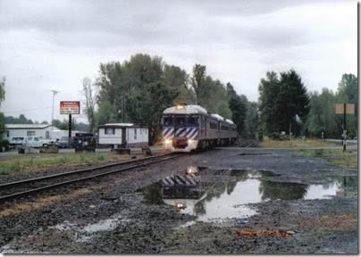
Lewis & Clark Explorer at Goble, Oregon on October 1, 2005
The Lewis & Clark Explorer at Goble, Oregon on October 1, 2005.

Continue to Rainier

Lewis & Clark Explorer: Tide Creek

…Continued from St. Helens.

tidecreeksign

Lewis & Clark Explorer at Tide Creek, Oregon, on September 24, 2005
The Lewis & Clark Explorer at Tide Creek, Oregon, on September 24, 2005.

Lewis & Clark Explorer at Tide Creek, Oregon, on September 24, 2005
The Lewis & Clark Explorer at Tide Creek, Oregon, on September 24, 2005.

Tide Creek is not really a town, it's a creek. However, if you mention Tide Creek to just about anyone from the area, they will think of the place where the railroad and Highway 30 cross Tide Creek and the highway intersects Tide Creek Road. Old Highway 30 closely followed the railroad grade here, and intersects with the road crossing the tracks just to the right of the photograph. The current Highway 30 crosses over Tide Creek on a large concrete viaduct, also to the right of the photo, keeping the highway fairly level. I waited for the train here, just because I thought it would be a photogenic location. The small wooden trestle over Tide Creek might date from the 1880s.

Lewis & Clark Explorer at Tide Creek, Oregon, on September 24, 2005
The Lewis & Clark Explorer at Tide Creek, Oregon, on September 24, 2005.

Continue to Goble

Lewis & Clark Explorer: St. Helens

…Continued from Scappoose.

sthelenssign

St. Helens is the county seat of Columbia County, and the largest city in the county. According to the 2000 census, St. Helens has a population of 10,019 people. The first sawmill was built here in 1844. At that time, St. Helens rivaled Portland as the major port city on the Columbia River. St. Helens was first called Plymouth and then Casenau, but was quickly renamed named after Mt. St. Helens, which is visible from the city. The first post office opened in St. Helens in 1853 and the town was chartered on February 25, 1889. St. Helens became the county seat of Columbia County in August 1903.

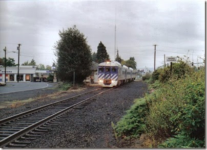
Lewis & Clark Explorer passing the depot at St. Helens, Oregon, on October 1, 2005
The Lewis & Clark Explorer passing the depot at St. Helens, Oregon, on October 1, 2005.

I photographed the train at the old St. Helens railroad depot. The depot was built in 1923. Even though there was no passenger service on this line after 1956, the depot was still used by the railroad as a base of operation for train and maintenance crews for decades. The depot was donated to the city of St. Helens in the 1990s, and was renovated into the city's Chamber of Commerce in 2000. It is one of only two railroad depots remaining on this line.

Lewis & Clark Explorer passing the depot at St. Helens, Oregon, on October 1, 2005
The Lewis & Clark Explorer passing the depot at St. Helens, Oregon, on October 1, 2005.

Continue to Tide Creek

Lewis & Clark Explorer: Scappoose

…Continued from Linnton.

scappoosesign

Scappoose is the first major city along the route. According to the 2000 census, Scappoose has a population of 4,976 people. Scappoose takes its name from a Native American word meaning "gravelly plain." Scappoose was first settled in 1842. The town was incorporated in 1921, though by that time such amenities as a school, post office and railroad depot had been in place for decades.

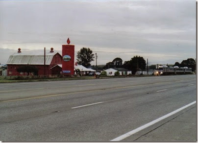
Lewis & Clark Explorer passing the Peace Candle of the World in Scappoose, Oregon on October 1, 2005
The Lewis & Clark Explorer passing the Peace Candle of the World in Scappoose, Oregon on October 1, 2005.

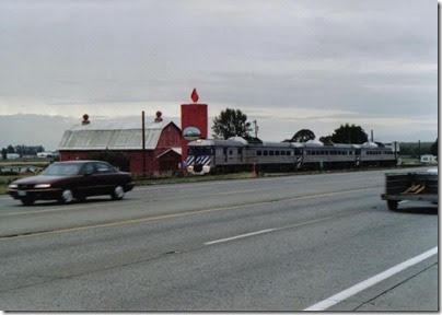
I waited for the train at the south end of town, because I wanted to photograph it passing the Peace Candle of the World. This giant candle was dedicated by Oregon Governor Tom McCall on May 9, 1971. The candle is 50 feet tall, 18 feet in diameter and contains 45,000 pounds of wax. An electric neon light at the top simulates a flickering flame. The barn and buildings adjacent to the candle once contained a candle factory and gift shop. I'm not sure which came first, the giant candle or the candle factory, but I do remember that the candle was sort of an advertisement for the factory. The candle used to be yellow, but was painted red after the candle factory closed.

Lewis & Clark Explorer passing the Peace Candle of the World in Scappoose, Oregon on October 1, 2005
The Lewis & Clark Explorer passing the Peace Candle of the World in Scappoose, Oregon on October 1, 2005.

Continue to St. Helens