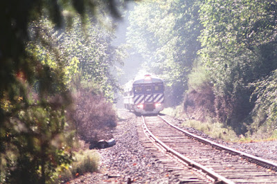
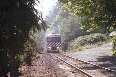
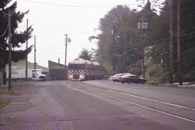
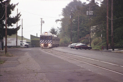
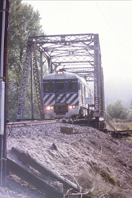
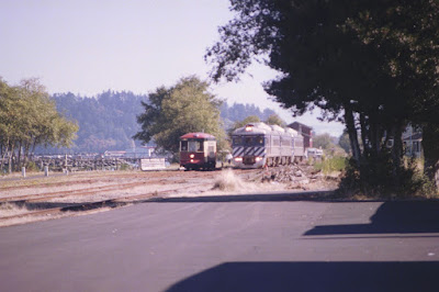
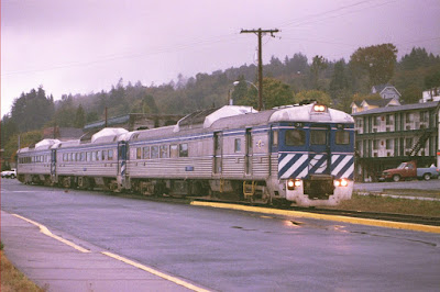
Leading the train, ORRX #31 is an RDC-3 originally built by Budd in July 1956 for the Great Northern Railway as #2350. The RDC-3 featured a section at one end of the car for baggage and mail. #2350 became Burlington Northern #2350 in 1970 and later became Amtrak #43. The British Columbia Railway purchased the car in January 1976 to replace their original #BC-31, which was destroyed in a fire on November 26, 1973. Trailing behind, ORRX #10 & #11 are RDC-1s built in August 1956 by Budd for British Columbia Railway's predecessor Pacific Great Eastern as #BC-10 and #BC-11. The RDC-1 was the passenger-only model of Budd's RDC line. The Pacific Great Eastern became the British Columbia Railway on April 1, 1972, when it was taken over by British Columbia's provincial government. The railroad began going by the name BC Rail on June 19, 1984. These RDC's are still in BC Rail paint, with only the BC Rail heralds replaced by the Lewis & Clark Explorer heralds.
How the three RDCs were coupled together varied. Sometimes the RDC-3 #31 was at one end, other times it was in the middle. The three were rarely separated, so they remained as they were coupled for quite a while.
Clatskanie takes its name from the Tlatskanai Indians, a very warlike tribe that inhabited this area. The Tlatskanai were wiped out by a smallpox epidemic in the 1850s. Clatskanie was first settled in 1852. It was originally called Bryantville. Clatskanie was incorporated in 1891. According to the 2000 census, Clatskanie has a population of 1,528 people. Unlike the other towns, which the railroad runs right through the middle of, the railroad only skirts along the edge of Clatskanie. At the west end of town, the railroad crosses the Clatskanie River on a swing-type drawbridge built in 1897.
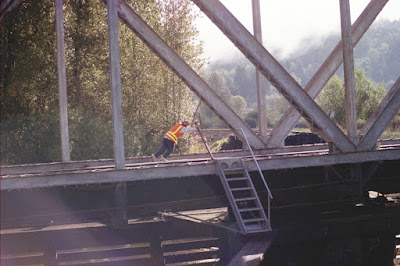
This bridge must be manually swung by a handcrank in the center of the span. This is the first of three manual drawbridges the train crosses. The bridge is normally kept open for river traffic, and is only swung closed when a train is waiting.
This is the bridge at which the Portland & Western freight train crew switching the Stimson Lumber mill at Clatskanie pushed a carload of lumber off the approach to the open drawbridge into the river on September 2, 2004. The train was operating on the east side of the bridge, so in the pictures it is the far approach that was damaged. Since the bridge was completely open at the time, the main span was not damaged.
This damage to the bridge approach closed the line for the entire Labor Day weekend, forcing that weekend's trips of the Lewis & Clark Explorer to be cancelled. The bridge approach was repaired and the line reopened in time for the rest of the season to be completed.
John West settled in Westport in 1850. The post office opened in 1863. Westport is located on Westport Slough, a side channel of the Columbia River. This location shelters the shore at Westport from the current in the river's main channel, making the slough a relatively good place for boaters and fishermen. Since 1925, a car ferry has connected Westport with Puget Island. This small ferry operation proves itself essential when construction or another emergency temporarily closes one of the bridges at Rainier or Astoria. This picture shows the westbound Lewis & Clark Explorer as it moves through Westport.
The town of Knappa was named after Aaron Knapp, Jr., an early settler of the area. The Knappa post office operated from 1873 to 1943. The actual town of Knappa is actually a little inland from the river, and the railroad stays close to the river here and doesn't actually go through Knappa. Two roads cross the railroad at Knappa. Knappa Road crosses above the tracks on an old wooden overpass. Waterhouse Road crosses the tracks at a traditional grade crossing. But this grade crossing is unique; it is still protected by an antique railroad crossing signal known as a Magnetic Flagman or wigwag.
Just north of the tracks, Waterhouse Road turns to intersect with Knappa Road, which is just to the east. The Knappa Road overpass is adjacent to the Waterhouse Road crossing, making this a very photogenic spot for train photographs. Unfortunately, the Portland & Western has no freight business this far down the line, so without the Lewis & Clark Explorer train, this area sees almost no rail traffic.
This type of signal was manufactured by the Magnetic Signal Company of Los Angeles, California from 1910 to 1949. It takes its name from the movement it makes; the black and white banner with the red light in the middle swings, "wigwags" back and forth. The movement is similar to that made by a human flagman while swinging a flag or lantern to stop traffic. The signal also features a bell. This wigwag was removed in March of 2007.
Astoria is the oldest settlement west of the Rocky Mountains. Fur traders sent by John Jacob Astor built Fort Astoria in 1811. Astoria is the county seat of Clatsop County. According to the 2000 census, Astoria has a population of 9,813 people.
The tracks along the waterfront through Astoria are used by the Astoria Riverfront Trolley.
The Lewis & Clark Explorer's journey ends, appropriately enough, in front of the old Astoria railroad depot. The depot was built in 1924, the peak year for rail travel in Astoria. The railroad continued to use the building for decades after passenger service ended, but today the building is owned by the Columbia River Maritime Museum. It is closed to the public as it is in need of serious repair and is only used for storage.
After leaving the street-running behind, the railroad crosses over Fox Creek on an old wooden trestle that probably dates from the railroad's original construction in the 1890s.














No comments:
Post a Comment