Showing posts with label Bridge. Show all posts

Saturday, August 30, 2025

Union Street Railroad Bridge

 IMG_3538 Union Street Railroad Bridge in Salem, Oregon on September 10, 2006

Union Street Railroad Bridge on September 10, 2006

The Union Street Railroad Bridge in Salem, Oregon, was built during 1912 and 1913.

IMG_3534 Union Street Railroad Bridge in Salem, Oregon on September 10, 2006
Union Street Railroad Bridge on September 10, 2006

The bridge originally connected West Salem, Dallas and Falls City on the other side of the river to the Southern Pacific Railroad along 12th Street via tracks down the middle of Union Street.

IMG_3531 Abandoned Tracks leading to Union Street Railroad Bridge in Salem, Oregon on September 10, 2006
This view looking east from the Union Street Railroad Bridge on September 10, 2006 shows the abandoned tracks from the bridge curving to align with Front Street. Note that if the tracks were straight (as they once were), they would go down the middle of Union Street in the background.

The railroad tracks were removed from Union Street in 1967, and the bridge was connected to the tracks in Front Street belonging to the Oregon Electric Railway, a subsidiary of the Spokane, Portland & Seattle Railway.

IMG_3532 Abandoned Tracks leading to Union Street Railroad Bridge in Salem, Oregon on September 10, 2006
The tracks leading from Front Street to the Union Street Railroad Bridge had clearly been out of service for a very long time when I took this picture on September 10, 2006, but I’m not sure if this dismantled rail joint was the work of metal thieves or was the railroad’s attempt at a permanent derail when the bridge closed.

The lift span was permanently closed to river traffic in 1980, and rail service across the bridge ended in the 1990s.

IMG_3533 Union Street Railroad Bridge in Salem, Oregon on September 10, 2006
Union Street Railroad Bridge on September 10, 2006

The City of Salem bought the bridge from the Union Pacific Railroad for $1 in 2003. It was placed on the National Register of Historic Places on January 11, 2006.

IMG_3530 Union Street Railroad Bridge in Salem, Oregon on September 10, 2006
Union Street Railroad Bridge on September 10, 2006

On February 21, 2007, the bridge received a $1,000,000 Oregon Transportation Commission Grant, and was scheduled to be converted into a bicycle and pedestrian bridge by the end of 2008.

Additional Links:
Historic Railroad Bridge at Salem Historical Quarterly
Union Street Railroad Bridge at Discover-Neighborhood-History
Interpretive Signs for the Union Street Bridge at Salem Heritage Network
Friends of Two Bridges in Salem, Oregon

Historical Photos:
Bridge Under Construction, 1912 (Salem Public Library)
Union Street Railroad Bridge, 1913 (Salem Public Library)
Bridge Opening, March 8, 1913 (Oregon State Library)
Bridge Dedication, 3/15/1913 (Salem Public Library)
Union Street Railroad Bridge, 1915 (Salem Public Library)
Union Street Bridge, Unknown Date (Salem Public Library)
Union Street Bridge in December, 1964 (Salem Public Library)
Union Street Bridge, Unknown Date (Salem Public Library)
Burlington Northern engine on bridge post-5/81 (pnwrailfan.com)Burlington Northern engine on bridge post-5/81 (pnwrailfan.com)


Tuesday, December 26, 2023

Lewis & Clark Explorer in 2005

Lewis & Clark Explorer at Rainier, Oregon, in 2005
Photo by Cliff West

To commemorate the bicentennial of the Lewis and Clark Expedition, the Oregon Department of Transportation operated an excursion train along the south bank of the lower Columbia River from Linnton, near Portland, to Astoria, near the site of Fort Clatsop, where the Lewis and Clark Expedition wintered over in 1805-06. The train ran for the summers of 2003 to 2005, making one round trip on Fridays, Saturdays, Sundays and Mondays. My dad, Cliff West, took these pictures of the train during its final season in 2005, around July. These first pictures show the westbound train approaching Rainier.

Lewis & Clark Explorer at Rainier, Oregon, in 2005
Photo by Cliff West

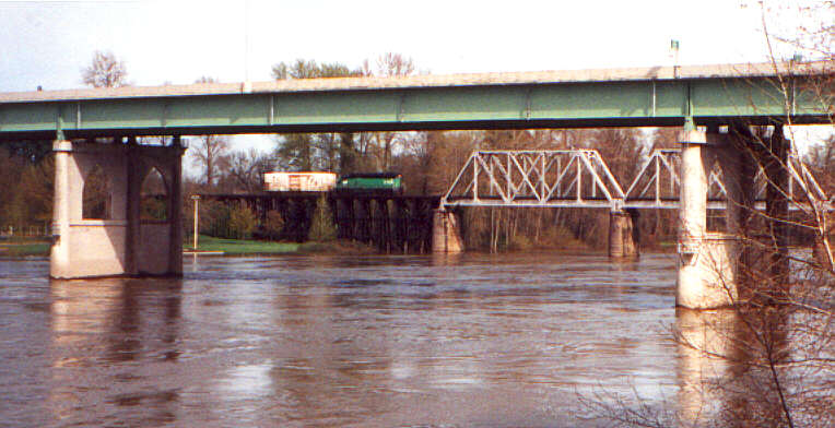
Charles Fox founded Rainier in 1851. The town was originally called Eminence, but the name was changed to Rainier in 1852. The town is named after Rear Admiral Peter Rainier of the Royal Navy, for whom Mt. Rainier in Washington is also named. The town of Rainier was incorporated in 1885. According to the 2000 census, Rainier has a population of 1,687 people.

Lewis & Clark Explorer approaching Rainier, Oregon, in 2005
Photo by Cliff West

On another day, the westbound train is shown approaching Rainier from another vantage point.

Lewis & Clark Explorer approaching Rainier, Oregon, in 2005
Photo by Cliff West

Rainier is my hometown, so it is covered more extensively than the other towns. 

Lewis & Clark Explorer at Rainier, Oregon, in 2005
Photo by Cliff West

The railroad runs down the middle of A Street in downtown Rainier. Street-running used to be common for railroads in the United States, but today it is becoming rare.
Lewis & Clark Explorer at Rainier, Oregon, in 2005
Photo by Cliff West

Later in the season, around September 2005, the westbound Lewis & Clark Explorer passes Riverfront Park in Rainier.

Lewis & Clark Explorer at Rainier, Oregon, in 2005
Photo by Cliff West

On another day around September 2005, the westbound Lewis & Clark Explorer runs down East A Street.

Lewis & Clark Explorer at Rainier, Oregon, in 2005
Photo by Cliff West

The train consisted of three self-propelled passenger cars known as Rail Diesel Cars, or RDCs, introduced by the Budd Company in 1949 and built throughout the 1950s. Budd was a major builder of railcars at the time, specializing in stainless steel streamlined passenger cars. These cars were purchased by the state of Oregon's Department of Transportation from the British Columbia Railway, which had ended its passenger service in 2002.

Lewis & Clark Explorer at Rainier, Oregon, in 2005
Photo by Cliff West

RDC's are powered by 2 Detroit Diesel Series 110 V-6 engines, each producing about 275 horsepower, giving each RDC about 550 horsepower. This is enough power for an RDC to move itself rather quickly, however an RDC does not have much power for pulling additional cars. As a result, each RDC in a consist must be operational. RDCs have a control cab at each end, and a single RDC can control all the other RDCs coupled to it. The hump in the roof at the center of an RDC contains the exhaust and cooling for the engines, freeing up space inside the cars for passengers.

Lewis & Clark Explorer at Rainier, Oregon, in 2005
Photo by Cliff West

Leading the train, ORRX #31 is an RDC-3 originally built by Budd in July 1956 for the Great Northern Railway as #2350. The RDC-3 featured a section at one end of the car for baggage and mail. #2350 became Burlington Northern #2350 in 1970 and later became Amtrak #43. The British Columbia Railway purchased the car in January 1976 to replace their original #BC-31, which was destroyed in a fire on November 26, 1973. Trailing behind, ORRX #10 & #11 are RDC-1s built in August 1956 by Budd for British Columbia Railway's predecessor Pacific Great Eastern as #BC-10 and #BC-11. The RDC-1 was the passenger-only model of Budd's RDC line. The Pacific Great Eastern became the British Columbia Railway on April 1, 1972, when it was taken over by British Columbia's provincial government. The railroad began going by the name BC Rail on June 19, 1984. These RDC's are still in BC Rail paint, with only the BC Rail heralds replaced by the Lewis & Clark Explorer heralds.

Lewis & Clark Explorer at Rainier, Oregon, in 2005
Photo by Cliff West

On another sunnier day around September 2005, the westbound Lewis & Clark Explorer runs down East A Street.


Lewis & Clark Explorer at Rainier, Oregon, in 2005
Photo by Cliff West

How the three RDCs were coupled together varied. Sometimes the RDC-3 #31 was at one end, other times it was in the middle. The three were rarely separated, so they remained as they were coupled for quite a while.

Lewis & Clark Explorer at Rainier, Oregon, in 2005
Photo by Cliff West

Near the end of the final season, in late September 2005, the westbound Lewis & Clark Explorer enters Rainier.

Lewis & Clark Explorer at Rainier, Oregon, in 2005
Photo by Cliff West

The Lewis & Clark Explorer was the first scheduled passenger service on this rail line since 1952.

Clatskanie River Drawbridge at Clatskanie, Oregon, in 2005
Photo by Cliff West

Clatskanie takes its name from the Tlatskanai Indians, a very warlike tribe that inhabited this area. The Tlatskanai were wiped out by a smallpox epidemic in the 1850s. Clatskanie was first settled in 1852. It was originally called Bryantville. Clatskanie was incorporated in 1891. According to the 2000 census, Clatskanie has a population of 1,528 people. Unlike the other towns, which the railroad runs right through the middle of, the railroad only skirts along the edge of Clatskanie. At the west end of town, the railroad crosses the Clatskanie River on a swing-type drawbridge built in 1897. 

Clatskanie River Drawbridge at Clatskanie, Oregon, in 2005
Photo by Cliff West

This bridge must be manually swung by a handcrank in the center of the span. This is the first of three manual drawbridges the train crosses. The bridge is normally kept open for river traffic, and is only swung closed when a train is waiting. 

Clatskanie River Drawbridge at Clatskanie, Oregon, in 2005
Photo by Cliff West

For freight trains, a railroad employee swings the bridge. For the Lewis & Clark Explorer, the bridge was swung by specially trained volunteers. 

Clatskanie River Drawbridge at Clatskanie, Oregon, in 2005
Photo by Cliff West

In these pictures, taken from the west side of the bridge, you can see the walkway to get to the span when the bridge is open, and the volunteer walking around the circular walkway in the middle, using the removable pole to turn the handcrank.

Clatskanie River Drawbridge at Clatskanie, Oregon, in 2005
Photo by Cliff West

This is the bridge at which the Portland & Western freight train crew switching the Stimson Lumber mill at Clatskanie pushed a carload of lumber off the approach to the open drawbridge into the river on September 2, 2004. The train was operating on the east side of the bridge, so in the pictures it is the far approach that was damaged. Since the bridge was completely open at the time, the main span was not damaged.

Lewis & Clark Explorer on the Clatskanie River Drawbridge at Clatskanie, Oregon, in 2005
Photo by Cliff West

This damage to the bridge approach closed the line for the entire Labor Day weekend, forcing that weekend's trips of the Lewis & Clark Explorer to be cancelled. The bridge approach was repaired and the line reopened in time for the rest of the season to be completed.

Lewis & Clark Explorer near Westport, Oregon, in 2005
Photo by Cliff West

Between Clatskanie and Westport the Astoria line closely parallels U.S. Highway 30. This picture shows the eastbound Lewis & Clark Explorer in this area.

Lewis & Clark Explorer at Westport, Oregon, in 2005
Photo by Cliff West

John West settled in Westport in 1850. The post office opened in 1863. Westport is located on Westport Slough, a side channel of the Columbia River. This location shelters the shore at Westport from the current in the river's main channel, making the slough a relatively good place for boaters and fishermen. Since 1925, a car ferry has connected Westport with Puget Island. This small ferry operation proves itself essential when construction or another emergency temporarily closes one of the bridges at Rainier or Astoria. This picture shows the westbound Lewis & Clark Explorer as it moves through Westport.

Lewis & Clark Explorer at Knappa, Oregon, in 2005
Photo by Cliff West

The town of Knappa was named after Aaron Knapp, Jr., an early settler of the area. The Knappa post office operated from 1873 to 1943. The actual town of Knappa is actually a little inland from the river, and the railroad stays close to the river here and doesn't actually go through Knappa. Two roads cross the railroad at Knappa. Knappa Road crosses above the tracks on an old wooden overpass. Waterhouse Road crosses the tracks at a traditional grade crossing. But this grade crossing is unique; it is still protected by an antique railroad crossing signal known as a Magnetic Flagman or wigwag.

Lewis & Clark Explorer at Knappa, Oregon, in 2005
Photo by Cliff West

Just north of the tracks, Waterhouse Road turns to intersect with Knappa Road, which is just to the east. The Knappa Road overpass is adjacent to the Waterhouse Road crossing, making this a very photogenic spot for train photographs. Unfortunately, the Portland & Western has no freight business this far down the line, so without the Lewis & Clark Explorer train, this area sees almost no rail traffic.

Wigwag Railroad Crossing Signal at Knappa, Oregon in 2005
Photo by Cliff West

This type of signal was manufactured by the Magnetic Signal Company of Los Angeles, California from 1910 to 1949. It takes its name from the movement it makes; the black and white banner with the red light in the middle swings, "wigwags" back and forth. The movement is similar to that made by a human flagman while swinging a flag or lantern to stop traffic. The signal also features a bell. This wigwag was removed in March of 2007.

Astoria Riverfront Trolley & Lewis & Clark Explorer at Astoria, Oregon, in 2005
Photo by Cliff West

Astoria is the oldest settlement west of the Rocky Mountains. Fur traders sent by John Jacob Astor built Fort Astoria in 1811. Astoria is the county seat of Clatsop County. According to the 2000 census, Astoria has a population of 9,813 people.

Astoria Riverfront Trolley & Lewis & Clark Explorer at Astoria, Oregon, in 2005
Photo by Cliff West

The tracks along the waterfront through Astoria are used by the Astoria Riverfront Trolley.

Lewis & Clark Explorer at Astoria, Oregon, in 2005
Photo by Cliff West

The Lewis & Clark Explorer's journey ends, appropriately enough, in front of the old Astoria railroad depot. The depot was built in 1924, the peak year for rail travel in Astoria. The railroad continued to use the building for decades after passenger service ended, but today the building is owned by the Columbia River Maritime Museum. It is closed to the public as it is in need of serious repair and is only used for storage.

Lewis & Clark Explorer at Rainier, Oregon, in 2005
Photo by Cliff West

Back in Rainier on another, wetter day, the Lewis & Clark Explorer makes one of its last trips down the middle of A Street.

Lewis & Clark Explorer at Rainier, Oregon, in 2005
Photo by Cliff West

The ditch lights on the front of the RDC shined brightly on this gloomy day.

Lewis & Clark Explorer at Rainier, Oregon, in 2005
Photo by Cliff West

The street running in Rainier ended at West 2nd Street, and the rail line ran alongside a narrower A Street from there.

Lewis & Clark Explorer at Rainier, Oregon, in 2005
Photo by Cliff West

On another day near the end of the final season, the Lewis & Clark Explorer runs down A Street in Rainier. 

Lewis & Clark Explorer at Rainier, Oregon, in 2005
Photo by Cliff West

At West 2nd Street, the train leaves the street and has its own separate right of way again.

Lewis & Clark Explorer at Rainier, Oregon, in 2005
Photo by Cliff West

After leaving the street-running behind, the railroad crosses over Fox Creek on an old wooden trestle that probably dates from the railroad's original construction in the 1890s.

Lewis & Clark Explorer at Rainier, Oregon, in 2005
Photo by Cliff West

I believe this was the last run of the Lewis & Clark Explorer on October 3, 2005.

Sunday, November 5, 2023

1997 MSOE Society of Model Engineers New Member Orientation Program

These pictures were taken at various locations in the Milwaukee area during the Milwaukee School of Engineering Society of Model Engineers New Member Orientation Program in December 1997, and were saved from the SOME files. All of these locations have some connection to trains.

Mitchell Park Domes in Milwaukee, Wisconsin, in December 1997
Mitchell Park Horticultural Conservatory

The Mitchell Park Horticultural Conservatory, more commonly known as the Mitchell Park Domes, consists of three glass conoidal domes designed by Donald L. Grieb Associates and built between 1959 and 1967, covering 45,000 square feet. During the winter, one of the domes features a garden railway display.

Train Ride at the Southridge Mall in Greendale, Wisconsin, in December 1997
Southridge Mall Train Ride

This train ride operated inside the Southridge Mall in the Milwaukee suburb of Greendale, Wisconsin. The Southridge Mall opened in 1970. This train (later repainted to resemble Thomas the Tank Engine) apparently operated until 2012 before being replaced by a trackless train in 2013.

Watertown Plank Road Overpass in Wauwatosa, Wisconsin, in December 1997
Watertown Plank Road Overpass

This bridge in the Milwaukee suburb of Wauwatosa, Wisconsin, was built in 1910 by the Cleary-White Construction Company of Chicago for the Milwaukee, Sparta & Northwestern Railroad, as part of a 9-mile double track line that opened in 1911 from West Allis north to Butler, location of a 21-track yard with a capacity of 1500 freight cars intended to relieve congestion from the yards in downtown Milwaukee. The 175-foot 7-panel riveted Parker through truss main span was built by the Pennsylvania Steel Company of Steelton, Pennsylvania, and carried the railroad over the route completed in 1855 by the Milwaukee & Watertown Railroad, a predecessor of the Chicago, Milwaukee, St. Paul and Pacific Railroad. Four approach spans built by the American Bridge Company of New York extend the bridge to a total length of 490 feet, crossing Underwood Creek and Watertown Plank Road, which began as a toll road in the 1830s. In 1912, the Milwaukee, Sparta & Northwestern Railroad was taken over by the Chicago & North Western Railway, which was merged into the Union Pacific Railroad in 1995. Meanwhile, the Chicago, Milwaukee, St. Paul & Pacific Railroad was purchased by the Soo Line Railroad in 1985, which was subsequently absorbed by its parent company Canadian Pacific in 1992.

Monday, February 12, 2018

Salt Creek Trestle

My dad took these pictures at Southern Pacific's Salt Creek Trestle in the Oregon Cascades while we stopped on a family vacation on our way to California on March 13, 1992. A forest service road off of Oregon Highway 58 provided access to one end of the Salt Creek Trestle. We didn't have to wait long for a Southern Pacific freight train to approach the trestle.

Southern Pacific SD40T-2 8557
Photo by Cliff West
Southern Pacific SD40T-2 #8557 led the train. It was built by EMD in 1979.

The first railway to directly connect Oregon and California was Southern Pacific's line over Siskiyou Summit, which was completed on December 17, 1887, but mountainous route featured sharp curves and grades of up to 3.67%, the steepest on the entire railroad. In the early 1900s, construction started on a new route through the Cascade Range over Pengra Pass, but came to a halt in 1912. Progress on this new Cascade Line, or Natron Cutoff, didn't resume until 1923. The line was completed on September 1, 1926, and opened to through passenger service on April 17, 1927. The new Cascade Line was 25 miles shorter than Siskiyou Line and had a maximum grade of 2.2%, but it was still a demanding route, with 44-miles of continuous grade.

Southern Pacific SD40T-2 8557 & SD45T-2s 9250 & 9337
Photo by Cliff West
Here are the three lead locomotives of the freight train starting across the Salt Creek Trestle. Southern Pacific SD40T-2 #8557 is in the front. It is followed by Southern Pacific SD45T-2 locomotives #9250 and #9337, which were built by EMD in June 1972 and February 1974 respectively.

All three of these locomotives are "Tunnel Motors," featuring a specialized cooling system designed for operation in tunnels and snowsheds in mountainous territory with overheating. The 3000-horsepower SD40T-2 can be distinguished from the earlier 3600-horsepower SD45T-2 by the access doors in the radiator section at the rear. The SD40T-2 has two access doors on each side, while the SD45T-2 has three. Also, the SD40T-2 uses a 16-cylinder engine instead of the 20-cylinder engine of the SD45T-2, allowing a shorter long hood, and making room in front of the cab for either an extra-long short hood or a "front porch."

The Salt Creek Trestle carries the Southern Pacific's Cascade Line over Salt Creek and Oregon Highway 58 near Heather, Oregon. It was built in 1924 and was fabricated by the American Bridge Company of New York. The steel trestle is 1200 feet long with individual spans of up to 125 feet.

Southern Pacific SD45T-2R 6854, SD45R 7417 & SD40T-2 8544
Photo by Cliff West
In the middle of the freight train were four Southern Pacific helper locomotives. These locomotives are necessary for the train to climb the steep grades and negotiate the tight curves of this mountainous route.

On the left is Southern Pacific SD45T-2R #6854. It was originally built by EMD in July 1972 as St. Louis Southwestern (Cotton Belt) SD45T-2 #9158. In September 1988 it was rebuilt by Southern Pacific's Sacramento Shops as Southern Pacific SD45T-2R #6854.

Next is Southern Pacific SD45R #7417. It was originally built by EMD in February 1967 as Southern Pacific SD45 #8846, and predates the "Tunnel Motor" radiator design. In December 1981 it was rebuilt by Southern Pacific's Sacramento Shops as Southern Pacific SD45R #7417.

The next locomotive is Southern Pacific SD40T-2 #8544. It was built by EMD in January 1979. 

The locomotive on the far right is a Southern Pacific SD45T-2, but its road number is not visible. I also can't tell whether or not it had been rebuilt into an SD45T-2R.

There were no more helpers on the rear end or even a bay-window caboose, only a Flashing Rear End Device, or FRED.

Monday, July 27, 2015

TriMet’s Westside Express Service (WES): Tualatin Station

I originally posted this on my old website on March 26, 2009.

IMG_5077 TriMet Westside Express Service Station Sign in Tualatin, Oregon on January 15, 2009
WES Station Sign in Tualatin, Oregon on January 15, 2009

The Tualatin Station is located at 18955 SW Boones Ferry Road.

IMG_5076 TriMet Westside Express Service Station in Tualatin, Oregon on January 15, 2009
WES Station in Tualatin, Oregon on January 15, 2009

It has the most sizable and visually-imposing platform on the WES line.

IMG_5072 TriMet Westside Express Service Station in Tualatin, Oregon on January 15, 2009
WES Station in Tualatin, Oregon on January 15, 2009

Nearly the entire platform is covered by a peaked roof.

IMG_5073 TriMet Westside Express Service Station Clock in Tualatin, Oregon on January 15, 2009
WES Station Clock in Tualatin, Oregon on January 15, 2009

IMG_5074 TriMet Westside Express Service Station Clock in Tualatin, Oregon on January 15, 2009
WES Station Clock in Tualatin, Oregon on January 15, 2009

The roof is topped by a 4-sided clock tower with clocks by Electric Time.

IMG_5070 TriMet Westside Express Service Station in Tualatin, Oregon on January 15, 2009
WES Station in Tualatin, Oregon on January 15, 2009

IMG_5067 TriMet Westside Express Service Station in Tualatin, Oregon on January 15, 2009
WES Station in Tualatin, Oregon on January 15, 2009

The Tualatin Station features a 154-space Park & Ride lot, 6 bike lockers and 24 covered bike rack spaces.

IMG_5071 TriMet Westside Express Service Station Sign in Tualatin, Oregon on January 15, 2009
WES Station Sign in Tualatin, Oregon on January 15, 2009

IMG_5075 TriMet Westside Express Service Station Sign in Tualatin, Oregon on January 15, 2009
WES Station Sign in Tualatin, Oregon on January 15, 2009

The station connects with TriMet's #76 bus line.

IMG_5069 Gauntlet Track at TriMet Westside Express Service Station in Tualatin, Oregon on January 15, 2009
Gauntlet Track in Tualatin, Oregon on January 15, 2009

The WES trains and the freight trains have to share the same track here.

IMG_5068 TriMet Westside Express Service Station in Tualatin, Oregon on January 15, 2009
Gauntlet Track in Tualatin, Oregon on January 15, 2009

Because of this, a gauntlet track is used. 

IMG_5066 Gauntlet Track at TriMet Westside Express Service Station in Tualatin, Oregon on January 15, 2009
Gauntlet Track in Tualatin, Oregon on January 15, 2009

This lets the WES trains get closer to the platform while still giving freight trains the clearance they need.

IMG_5061 Southern Pacific over Oregon Electric in Tualatin, Oregon on January 15, 2009
Trestle Crossing in Tualatin, Oregon on January 15, 2009

Just north of the Tualatin Station the WES line passes Tualatin Community Park and passes underneath another rail line. The rail line that crosses over the WES line was originally built in 1886 as the narrow-gauge Portland & Willamette Valley Railway Company between downtown Portland and Dundee, through Lake Oswego and Newberg. Within a few years it was taken over by the Southern Pacific Railroad and standard-gauged, and between 1914 and 1929 the line was used by Southern Pacific's "Red Electric" interurbans, a competitor of the Oregon Electric Railway that originally operated the line WES now runs on, carrying passengers between Portland and Corvallis.

IMG_5060 Southern Pacific over Oregon Electric in Tualatin, Oregon on January 15, 2009
Trestle Crossing in Tualatin, Oregon on January 15, 2009

These lines remained competitors into the 1990s, with the Oregon Electric having become part of Burlington Northern Santa Fe while the Southern Pacific became part of Union Pacific. Today, both are operated by the Portland & Western Railroad.

IMG_5056 Oregon Electric Tualatin River Bridge in Tualatin, Oregon on January 15, 2009
Tualatin River Bridge in Tualatin, Oregon on January 15, 2009

At the north end of Tualatin Community Park, the WES line crosses the Tualatin River on this truss bridge. This truss span may date from the original construction of this line as the Oregon Electric Railway in 1906. The long north approach of this bridge was rebuilt to accommodate WES trains, but the main span and short south approach remain.

The following video shows a WES train crossing this bridge during a demonstration trip on January 21, 2009.

WES Train at Tualatin River Bridge on January 21, 2009.

Continue to Tigard Transit Center